Civil War Room |
|
|
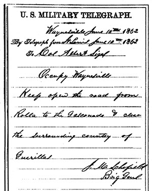
| On June 10th, 1862, Brigadier General John Schofield sent a telegram to Colonel Albert Sigel. The message read, "Occupy Waynesville, Keep open the road from Rolla to the Gasconade & clear the surrounding country of guerillas." The McDonalds had been experiencing a period of prosperity but Sigel's arrival ended that. Colonel Sigel commandeered McDonald's building to serve as a hospital for his 13th Missouri State Militia Regiment (soon to be renumbered as the 5th MSM). Surgeon John Fetzer was the first doctor in charge of the infirmary. |
 |
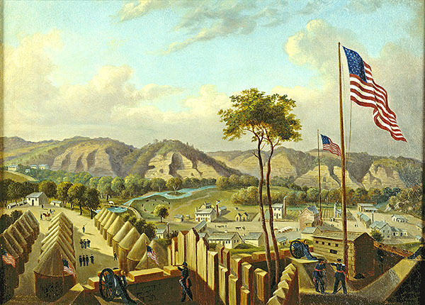 |
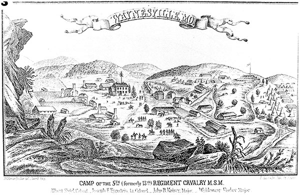
| We have two graphic representations of Waynesville during the Civil War and the location of the Old Stagecoach Stop. Neither are photographs so are subject to the interpretations of the artist. The first is a pen/ink sketch done by Major Woldemar Fischer in 1863 (left). The vantage point is from the top of Bell Bluff to the west of town looking eastward. The fort built by Sigel's men is depicted on the hill to the south of town, marked by a very tall flagpole. The number of buildings seem to be correct as the 1860 census enumerates fourteen residences. An artist known only as Leuteritz produced the oil painting in 1864 (right). His view is from inside the fort on the hill looking north onto the village. The fort and courthouse are also flying Union flags atop very tall flagpoles. The detail at right shows McDonalds building across from the courthouse (arrow). |  |
| When first entering the Civil War Room from the McDonald Cabin, the operating table catches the eye. It is typically assembled from two wooden barrels with a wooden interior door straddling the barrels. The door is covered with a gum blanket, a rubberized cloth generally used as a poncho or ground cloth. | 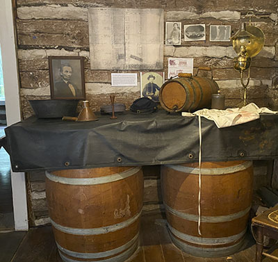 |
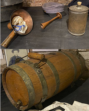
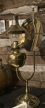
On the operating table are several items used in medical procedures. In the upper inset, the period stethoscope is framed by a copper anesthetic application mask and a tin canister to hold the anesthetic. Union doctors had available both ether and chloroform. The early stethoscope was developed by a French physician and was monaural, consisting of a flared hollow wooden tube and used on one ear. The bottom inset is an ambulance water cask that was suspended below the ambulance's chassis. It holds about eight gallons. At the far right is a 29-inch tall surgeon's oil lamp. |
 |
 |
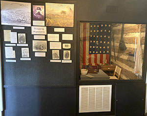 |
The east wall of the room features a panel of information describing persons and events during the building's occupation during the war. | 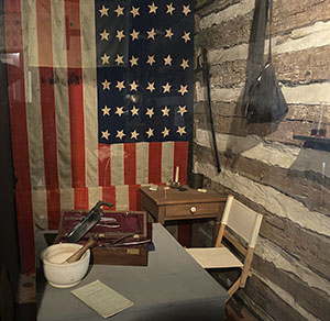 |
The surgeon's office is viewable behind a plexiglass partition. On the surgeon's table in the foreground is a mortar and pestle for medicine preparation. Behind that is a major amputation kit. Hanging on the back wall is a Civil War era flag with 36 stars that belonged to an Iowa regiment. |
 |
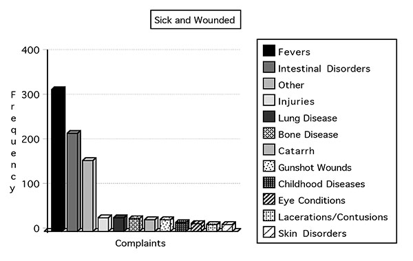 |
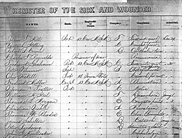
| We do have records of the hospital's patients from May 24 through October 27, 1863. Part of a page is pictured above left. One of the 13 columns of patient information lists the "Complaint" or reason for visiting the infirmary. During this period, 905 soldiers were registered at the hospital, mostly for fevers of various types and intestinal disorders. Gunshot wounds comprised only 2.8% of admissions. This was generally true for other locations during the war. Two-thirds of the fatalities during the Civil War were from disease. Of the 618,000 deaths on both sides, 414,000 were the result of disease. Thirty-two (32) soldiers died of disease at the Post Waynesville Hospital during this seventeen month period. |
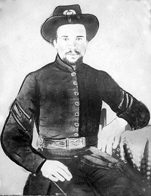 |
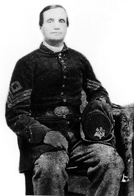
William B. Phillips (left) was the Hospital Steward at Post Waynesville beginning in early 1863, serving a series of contract physicians until the end of the war. He married Elizabeth Wilcox "at the residence of W.W. McDonald" on August 31, 1864. After paying a commutation tax for exemption from military service in 1863, W.W. subsequently volunteered to serve in the 48th Missouri Infantry Volunteers. His first term began as a private in April of 1864, age listed as 44. He served a second term as first sergeant of Company C in July of the same year. |
 |
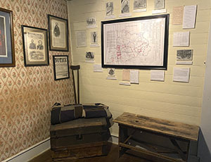 |
The north wall also presents graphics concerning Civil War people and events. There is also a large map, Civil War and the Ozarks, that locates battles and skirmishes in the Ozarks of southern Missouri and northern Arkansas. By the end of the war in 1865, Pulaski County was mostly depopulated. |